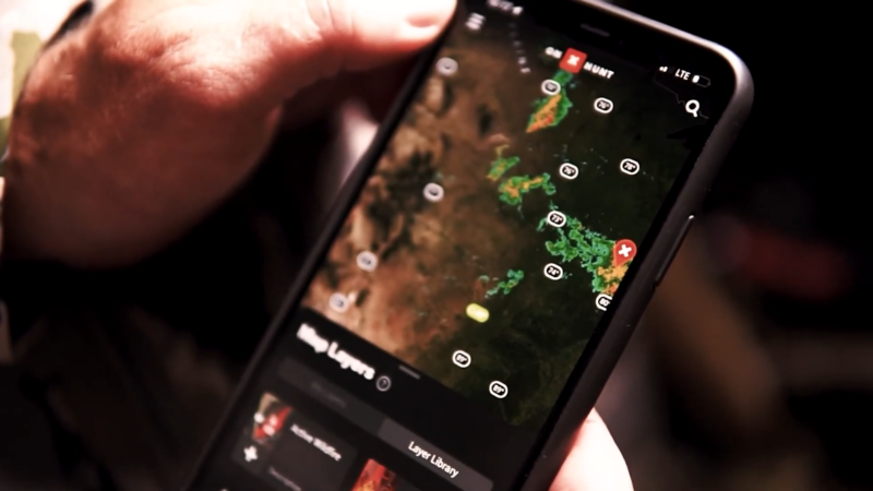
Technology has changed the game, making it possible to predict animal movement, navigate public and private lands, and track weather conditions—all from your smartphone.
Imagine knowing exactly where to hunt, when animals are most likely to be active, and how wind direction could impact your chances of success. That’s the kind of advantage today’s hunting apps provide.
But with so many options out there, which ones actually help you hunt smarter?
I’ve tested and reviewed the 10 best hunting apps that offer detailed maps, tracking tools, real-time weather updates, and predictive algorithms.
Whether you need an app for GPS navigation, deer movement forecasts, or logging your hunts, you’ll find the right tool to improve your hunting strategy in this list.
1. onX Hunt – Comprehensive Mapping and Land Data
onX Hunt is a premier hunting app renowned for its detailed mapping capabilities, offering insights into property boundaries, landowner information, and access to both public and private lands. Its offline map access ensures functionality even in areas without cellular service.
Key Features
Real-World Application
Imagine planning a hunt in a densely wooded area with limited cell service.
With onX Hunt’s offline maps, you can navigate confidently, knowing property boundaries and optimal routes, ensuring a safe and legal hunting experience.
Pricing
Plan
Price
Coverage
Premium
$34.99/year
Single State
Elite
$99.99/year
All 50 States
2. HuntStand – Integrated Mapping and Weather Tools
HuntStand combines advanced mapping with weather forecasting, offering hunters tools to create and manage hunting areas, access property information, and receive detailed weather updates.
Its social component fosters a community for sharing information and strategies.
Key Features
- Property Boundaries: Access to property lines and landowner details.
- Custom Hunting Areas: Create and manage specific hunting zones.
- Weather Forecasts: Detailed weather information, including wind direction and speed.
- Social Integration: Connect with other hunters to share insights and strategies.
Real-World Application
Before heading out, you can use HuntStand to check wind patterns, ensuring you’re positioned downwind of game trails.
By marking hunting areas and sharing them with friends, you coordinate effectively, enhancing safety and success rates.
Pricing
| Plan | Price | Features |
| Free | $0 | Basic features with ads |
| Pro | $29.99/year | Removes ads, unlocks advanced features |
| Pro Whitetail | $69.99/year | Includes all Pro features plus specialized tools for whitetail deer hunting |
3. ScoutLook Hunting – Weather-Centric Hunting Companion
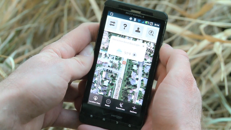
ScoutLook specializes in weather-focused features, notably its ScentCone system, which illustrates how wind conditions can affect scent dispersion—a crucial factor for hunters.
The app also provides mapping tools, game logging, and detailed weather forecasts.
Key Features
- ScentCone™ Wind Map: Visual representation of scent dispersion based on wind conditions.
- Weather Forecasts: Detailed, location-specific weather information.
- Game Logging: Record sightings, harvests, and observations.
- Mapping Tools: Mark hunting spots, trails, and stands.
Real-World Application
By analyzing the ScentCone feature before a hunt, you can position yourself to remain undetected by game, increasing the likelihood of a successful outing.
Pricing
ScoutLook is free to download, with premium features available through in-app purchases.
4. HuntWise – Predicting Animal Movement with Smart Algorithms
View this post on Instagram
Hunting success often comes down to timing and location. HuntWise helps take the guesswork out of it by using predictive algorithms based on weather conditions, moon phases, and barometric pressure to forecast deer movement.
This means you don’t have to rely purely on instinct—you’ll have data-driven insights about when animals are most likely to be active. Whether you’re hunting whitetail, elk, or turkey, HuntWise gives you a probability score so you can make smarter decisions before heading out.
Why It’s Great
- Game Movement Forecasts: Uses AI and real-time weather data to predict deer, elk, and turkey activity.
- Property Boundaries: Access private and public land ownership details.
- Wind Tracking: Provides detailed wind maps to help you stay downwind.
- Hunting Communities: Connects hunters through a built-in social platform for sharing strategies.
Real-World Example
Let’s say you’re targeting a mature buck in a wooded area, but you don’t know when it’ll be moving. HuntWise might tell you:
- Morning (7 AM – 9 AM): 40% chance of movement
- Evening (4 PM – 6 PM): 85% chance of movement
With this knowledge, you plan your hunt accordingly, increasing your chances of success.
Pricing
| Plan | Price | Features |
| Pro | $49.99/year | Predictive animal movement, property boundaries, weather tracking |
| Elite | $99.99/year | All Pro features + more advanced AI-based movement forecasts |
5. Powderhook – Finding New Hunting Land for Free
One of the biggest challenges for hunters is finding legal land to hunt on. Powderhook solves this by offering an interactive map of public lands, including wildlife areas and state parks, across the U.S.
Unlike other apps that require a subscription, Powderhook is completely free—making it an excellent option for budget-conscious hunters.
Why It’s Great
- Free Public Land Access: Helps locate nearby legal hunting grounds.
- Community Engagement: Connects you with fellow hunters for advice.
- Hunting Events & Mentorships: Features programs to help beginners learn the ropes.
Real-World Example
Imagine you’re traveling to a new state and don’t know where to hunt. Instead of spending hours researching, you open
Powderhook, input your location, and find the nearest public land available for hunting.
Pricing
| Plan | Price | Features |
| Free | $0 | Public land maps, access points, mentorship program |
6. Quiver – Best Hunting Journal for Tracking Patterns
Serious hunters don’t just rely on memory—they log their hunts to track animal patterns over time. Quiver acts as your digital hunting diary, allowing you to record sightings, weather conditions, and moon phases for each trip.
Why It’s Great
- Hunting Logs: Record kills, sightings, weather, and moon phase.
- Data Analysis: Helps you spot long-term trends.
- Cloud Backup: Never lose your hunting data, even if you switch phones.
Real-World Example
Over a few seasons, you notice that deer tend to appear near your stand around 6:30 PM on full-moon nights. With this insight, you can optimize future hunts and be in position when they are most active.
Pricing
| Plan | Price | Features |
| Free | $0 | Basic hunt logging |
7. Antler Insanity – Budget-Friendly GPS Mapping for Hunters
New AI iPhone app update just hit the app store! https://t.co/fvuL4CEQ9V @KennaLee1 @insanitybigd @DavisDeanO
— Antler Insanity (@Antler_Insanity) November 11, 2013
For those looking for a free but functional hunting GPS app, Antler Insanity offers a simple yet effective alternative to premium mapping apps like onX Hunt and BaseMap.
While it may not have the sleek interface or extensive layering features of paid apps, it gets the job done with GPS tracking, waypoint marking, and offline boundary maps.
Why It’s Great
- Reliable GPS Navigation – Helps track your movements, set waypoints, and navigate unfamiliar terrain.
- Offline Capabilities – Even if you’re in a remote hunting spot with zero service, your maps remain accessible.
- Completely Free – No subscription fees or hidden costs, making it ideal for hunters on a budget.
Real-World Example
You’re deep in the backcountry, and as the sun sets, you realize you’ve lost track of the exact path back to camp. Instead of panicking, you pull up Antler Insanity, follow the waypoint you marked at camp, and safely navigate your way back without needing cell service.
Pricing
| Plan | Price | Features |
| Free | $0 | Basic GPS navigation, waypoint marking, and offline property boundaries |
8. BaseMap – High-Resolution Satellite Mapping with Real-Time Sharing
View this post on Instagram
When detailed topographic maps and live tracking are your top priorities, BaseMap delivers a powerful alternative to onX Hunt at a lower cost.
This app provides high-resolution satellite imagery, customizable map layers, and real-time location sharing, making it an excellent tool for both solo and group hunting expeditions.
Why It’s Great
- Crystal-Clear Satellite Imagery – Navigate terrain with high-definition, topographic, and 3D maps.
- Custom Map Layers – Add overlays for hunting units, game zones, and property boundaries.
- Offline Access – Download maps ahead of time and use them without an internet connection.
- Location Sharing – Helps hunting groups stay connected and track each other in real time.
Real-World Example
You and a friend are scouting a large national forest for an elk hunt. Instead of splitting up blindly, you both share your live location through BaseMap, ensuring you can coordinate movements and regroup quickly if needed.
Pricing
| Plan | Price | Features |
| Pro | $29.99/year | High-resolution maps, real-time location sharing, offline access, custom layers |
9. DeerCast – Predicting Deer Movement Like a Pro
@whitetail_edge One of my favorite features on @deercast_app . We use DeerCast on a daily basis for many reasons, but the topo layer on the map is one of the best. . It’s easy to read and quickly determine where those ridge systems come together and where a big buck might typically cruise through during the rut checking for does. . This can easily help you determine where you might want a @novixoutdoors stand or a @black_widow_deer_lures scrape trap like we’ve done so often, resulting in harvesting a giant whitetail. . #deer #deerhunting #whitetailbuck #whitetails #huntingmaps #deercast ♬ original sound – Whitetail_edge
Whitetail hunters know that timing is everything, and DeerCast helps take the guesswork out of when to be in your stand. Using a combination of weather data, wind conditions, moon phases, and rut activity, DeerCast predicts the best times for deer movement with a day-by-day and hour-by-hour rating system.
Why It’s Great
- Daily Deer Movement Forecasts – Uses weather patterns and AI to predict the best hunting windows.
- Exclusive Hunting Tips & Videos – Get expert insights from the Drury Outdoors hunting team.
- Community Discussion Forum – Join other hunters to discuss tactics, strategies, and sightings.
Real-World Example
You’re trying to decide between a morning hunt or an evening hunt during the pre-rut. You open DeerCast and see that movement predictions are 80% higher just before sunset.
Instead of wasting energy on a low-activity morning hunt, you wait for the evening sit—and sure enough, a mature buck moves in range just as predicted.
Pricing
| Plan | Price | Features |
| Basic | Free | Daily movement forecasts, basic hunting tips |
| Elite | $19.99/year | Advanced movement predictions, premium Drury Outdoors content |
Final Words
If I had to choose just one hunting app that truly delivers on mapping, tracking, and real-time hunting intelligence, it would be onX Hunt.
Why? Because having accurate land data, offline maps, and precise GPS tracking can make or break a hunt. Whether you’re deep in public lands, navigating private property boundaries, or scouting new hunting grounds, onX Hunt gives you the confidence to move smart, stay legal, and hunt efficiently.
While other apps offer great predictive features and weather insights, they still rely on you being in the right location. With onX Hunt, you know exactly where to go, how to get there, and where to set up for the best shot possible.